


Trip Facts
- Duration 20 Days
- Start FromKathmandu
- Group Size1-10 Pax
- End FromKathmandu
- Trip GradeModerate to Strenuous
- Max Height 5416 m
- AccommodationTea House
- TransportationCar/Bus
Best Season
Sept – Nov, March to May
Trip Highlights
- High altitude trek to Thorang La Pass (5,416 metres)
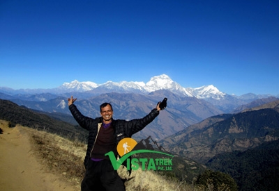
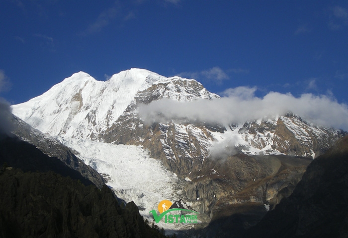
- Magnificent views of three different Himalayan Ranges, with each one including one Himalaya above 8000 metres: the Annapurna Range, the Manaslu Range and the Dhaulagiri Range
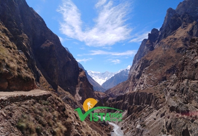
- Passes through two interesting valleys: the Marshyandi River Valley and the Kali GandakiValley which also includes the deepest Gorge of the world
- Animals of interest: domesticated Yaks and a number of wild birds and animals including endangered Musk Deer, Tahr as well as several species of Eagles and Vultures
- Vegetation: from tropical to subtropical to Temperate to sub-alpine to alpine beyond the tree-line as well as apple farms in some places
- Passes through settlements that highlight the cultures of more than six different ethnic groups
Trip Overview
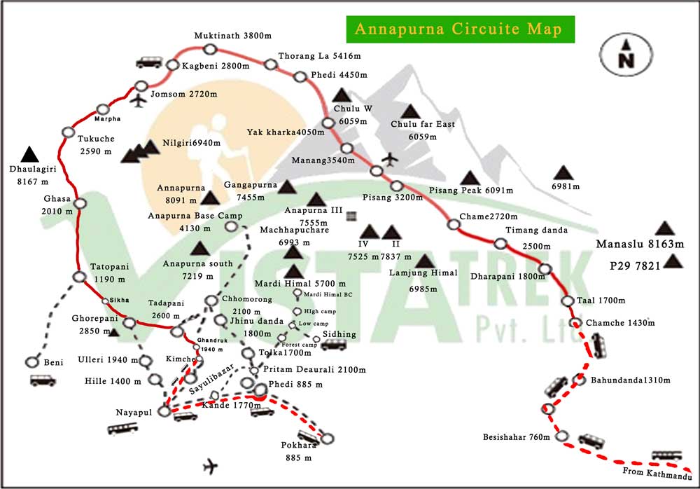
Annapurna Circuit Trek is the most popular trek in Nepal. The Annapurna region lies in the middle north of Nepal and spreads over the Kali Gandaki River to the west, the Marshyangdi and Dudh Khola valleys to the east, the Pokhara valley to the south, and the Himalaya foothills that run along the Nepal-Tibetan border to the north.
The Annapurna Conservation Area was established in 1986 under the National Trust of Natural conservation. The slogan for this project was ‘Conservation is not a separation of people from nature.’ The program began by educating the local lodge owners in hygiene and sanitation matters, fuel diversity by moving away from using local forest timber and in local cultural maintenance. ACAP, a non-governmental organization, has directly supported and encouraged the development of the local infrastructure and income-generating activities in environmentally sensitive ways, solar power, bio-gas cooking, and bio-degrading toilet systems.
All this has resulted in the area providing some of the best trekking services to be found in Nepal. This is the most popular trekking region ever in the world, which attracts more than 75% of the whole trekkers in Nepal. It’s also the tamest area with excellent lodges lining in the main routes. Finding Nepal beneath the flood of trekkers can be difficult but her scenery and culture are top-notch, and you can avoid the peak-season crush and still get fine weather and views.
If you wish to do the easy and short trek as compared to Annapurna Circuit, Mardi Himal Trek and Annapurna Base Camp trek might be suitable for you.
Trip Itinerary
- Upon arrival at Tribhuwan Intl Airport in Kathmandu, a representative from Vista Trek waiting, well in time, to receive you, shall welcome you to this land of the towering Himalayas. Once reaching your hotel in a car from the airport, all you need to do is check in and enjoy the refreshment served.
- We then visit the Vista Trek office for discussion on trekking, introduction to the guide and porter and settlement of dues if any. Since you often still have some time left for a walk around Thamel, you can do so if you please.
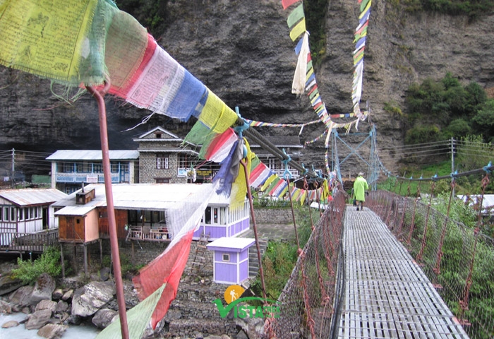
- We head off to Beshisahar on a local bus early morning. Along the banks of the famous Trishuli and Marshyndi river, this almost six-hour journey takes all its passengers on a ride, albeit with some bumps here and there, through numerous important settlements, presenting the views of some of the Himalayas to the North. With guaranteed two stops for breakfast and lunch, the bus ride comes to its final stop in Beshisahar. Beshisahar, a small town with Gurung dominance, has grown in popularity as a trail head for Annapurna Circuit Trek since the 1990s.
- Spend the night in a hotel in the town.
- After breakfast, we go to Chamje Village on a two-and-a-half-hour drive in a public vehicle. On a dirt road all the way, the vehicle in motion presents spectacular views through its windows: Ghermu and Chamje waterfallson the way as beautiful as ever, the Marshyandi River to the right throughout as determined as ever and Mt Manaslu beyond the hills as majestic as ever. The ride certainly is no miserly.
- After lunch in Chamje, we walk for around two hours and a half to Tal Village. On this first day, the fresh legs don’t often seem to mind this gradual uphill through a dense green forest for around two hours, allowing the shades of green to influence myriad people in myriad ways. The trek finally enters Tal Village.
- Spend the night in a teahouse in the village.
- After breakfast, we walk for around 3 ½ hours to Bagarchhap. Mostly gradual up, with sharper ups and even slight downs at places, the trail meanders along Marshyandi River all the way up to Bagarchhap, our stopover for lunch. For everyone traversing, the route also presents a peak into the lifestyle of a typical village found in the Annapurna Region today:adults, working in their terraced farms; kids, running after the smaller of the types of some of the domesticated animals such as a hen or a duck;cowherds, tending their grazing cattle; some of the elderly, basking in the sun; close-knit homes made of mainly stones or wood, many on the main street serving as teahouses aimed at travelers;located on the foothills or on a relatively flat area or evenon the slopes of the hills.
- Once reachingDanaque Village, the remaining is a trek up a sharp uphill until TimangDanda. Serving as a vantage point to view Mt Manaslu and its surrounding mountains,this small settlement was developed to its current state largely for tourism purposes.
- Spend the night in TimangDanda.
- We start trek after breakfast and stop at Thanchok Village in about an hour and a half’stime. With the beauty of the landscape similar to the ones before, with apple farms along the way and with the addition of the towering Annapurna II above the high hills to the West, the almost flat trail throughout serves as some respite on the legs that are first timers.
- We walk again for 2 ½ hours to Chameafter a cup of tea or coffee in Thanchok. The path from here on is similar to the one before. Chame, the headquarters of Manang District, boasts its affluence, reflected in the constructions and even in its way of life, over other settlements found in the Region. During lunch, an option on the menu is a typical Nepali meal served for lunch, the famous Dal BhatTarkari. The foodcomes as a welcome adventure for some and ‘don’t know what to say’ to this new experience for others, depending largely on how the tongue and later the body have beentamed to respond to the sensations of food.
- After breakfast, we walk for about three hours to DhukurPhokhari. Out of Chame, across suspension bridges, through pine forests, up and down, through Bhartang Village and up a steep climb, the trail, finally, reaches DhukurPokhari on a ridge.
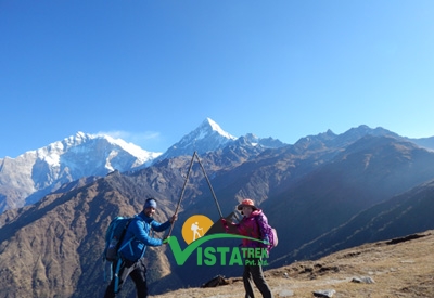
- After lunch, we start walking again for about two and a half hours to Pisang. With the Pisang Peak and Mt Chulu in view all the way, the route enters Pisang Village. After ascertaining a comfortable stay, the village invites its guests to a tour of Upper Pisang –Tibetan style houses, monasteries, a panoramic view of the Annarpurna range, Gangapurna range and the valley below.
- Spend the night in a teahouse in the village.
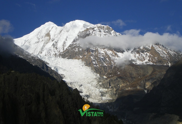
- We start trek after breakfast and stop at Humde Village after around 3 hours’ walk. Still in the company of a pine forest, in the guidance of a gentle uphill for about half an hour to the top of the ridge, now in the sight of the Manang Valley as well as the short airstrip in Humde Village, in the presenceof the massive Annapurna II and III together with Mt Gangapurna and Mt Tilichoas witnesses, … this part of the trek is a proof of a walk amidst the Himalayas.
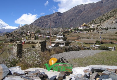
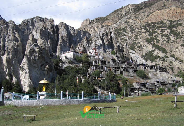
- After lunch in Humde, we walk again for about 2 hours to Manang Village. The trail that levels off from here on sees the pine woods thinning out as the bare hillsides start surrounding it on its way to Braga, a village built into the hillside and topped with a centuries old monastery well worth a visit. With the valley widening out from this point on and herds of yaks grazing on scarce patches of vegetation on the way, the route leads to Manang Village in slightly less than an hour from Braga.
- Spend the night in a hotel in Manang Village.
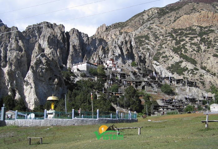
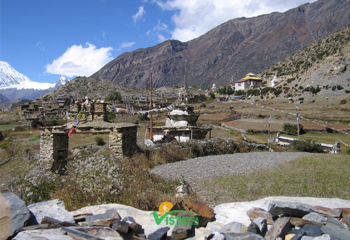
- We take a walk around after breakfast. Known as the Shangri-La, the settlement, the largest village in Manang District, radiates a distinct Buddhist aura –prayer wheels, prayer flags, prayer stones and mani walls.
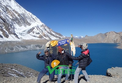
- We hike to Gangapurna Lake before lunch. The blue-green lake, fed directly by the Gangapurna glaciers, appears like a large body of still water in the crater of a volcano. A gentle walk of around 300 metres up the hill to the left of the lake serves as a vantage point, welcoming its visitors, standing at an altitude of 3,800 metresto experience a wide view of the notable peaks of the Annapurna Region from just above the magnificent Lake – Mt Annapurna II and III, Mt Gangapurna, Mt Tilicho, Mt Chulu as well as a large portion of the Marshyangdi River Valley including the settlement of Manang.
- Walk back to Manang Village and spend the night in a hotel.
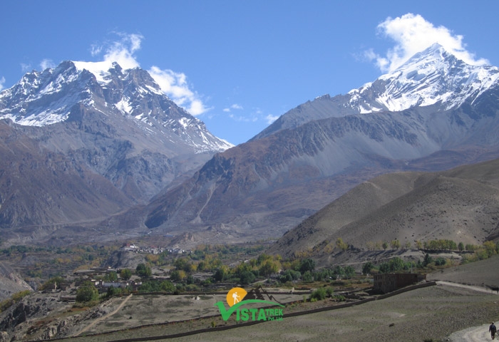
- After breakfast, we walk for about 2 hours to Gunsang. Although the path is a gradual uphill throughout, the altitude makes up for its earthen mate, making it arduous in a moreexhausting sense than painful, owing much to the thinning of the air in higher altitudes. The gradual decline in vegetation, which finally gives in to the nature leaving the landscape almost barren by the next two hours’ walk, also cautions everyone traversing of the harshness of the terrain. The tea break at Gunsang comes as a welcome retreat after an hour and a half’s walk. Blown away by the view from this point, many are, in fact, forced to stop for around half an hour in appreciation; along with the Annapurna Range and Marshyandi River Valley with Manang Village still visible but distancing away, the panorama now also includes the Manaslu Range beyond the end of the valley.
- We start walking again after this break to Yak Kharka. Developed solely to facilitate trekkers, the small settlement in Yak Kharka is ideally located for a much better view of Mt Chulu than from most other places in the region.
- Spend the night in a teahouse in this settlement.
- We start trek after breakfast and stop at a small tea hut after around 2 ½ hours’ walk. Bringing the Thorang Peak closer and closer, bringing inthe West of Mt Chuluin view round a hill in about half an hour, presentinga small streamto cross after the next hour, the route turns uphill from here on.Along the way, the relative discomfort of the trail is well compensated by the sight of a herd of Tahrjumping on rocky slopes most would not dare to.The first of the only two huts in this part of the trail approaches, encouraging a short break. Providing tea and coffee and selling only a few items such as chips, cookies and chocolates, the service, run by a couple in their thirties, comes without any proper sitting arrangement; the best anyone is likely to get is a roughly nailed plank on two single bamboo pillars on each side.
- After this break, we walk again for an hour and a half to ThorangPhedi. A gradual uphill along a stream all the way, the trail calls for exercising extra caution against falling stones at some of its reconstructed parts that get in the way of the landslides each year. In about an hour and a half, the trail brings its travelers to ThorangPhedi for lunch. The only twoconstructions in the area are able to render their services to around 200 people at a go, enough even for the crowd in the peak season.
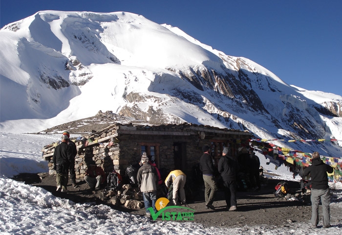
- After lunch, we startwalking once more for nearly an hour to Thorang High Camp. Testing times. This hour long steep uphill into higher lands after almost four hours of lumbering on this tenth dayappears never ending, lending strength to the concept of relativity with regard to distance, time and difficulty. The sight of two buildingsclosing in, towards the final stages of this stretched hour,would perhaps never look so rewarding except in times like these. To everyone’s relief, of the two, the biggerremains open throughout.
- Spend the night here.
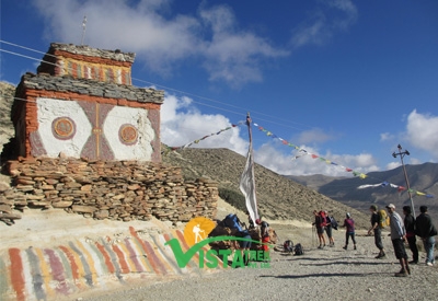
- We start trek early morning (at around 5 am) and stop at Thorangla Pass after approximately three and a half hours. After a very early tea, we pack our lunch and start the walk up a meandering incline. Known for its indiscriminating character, this gruesome steep climb is the most challenging of all days claim many. The only relief on this part for any trekker is, perhaps, the thought that one would soon have a first-hand experience of stopping by in Thorangla Pass, the one at the highest altitude of 5,416 metres.With Thorang Peak right above the head, the Pass today also houses prayer flags along with the regular ice and boulders. For us, it’s breakfast time on thisborder that separates Manang and Mustang Districts.
- After breakfast, we walk again for two and a half hours to ThorangPhedi, leaving Manang and officially entering Mustang. A gradual downhill, unlike a waterfall but more like a steady river, brings MtDhaulagiri in sight after around ten minutes.The surrounding, barren desert-like landscape, presents harsh conditions challenged only bya few species of adamant shrubs and grasses. The arrival of ThorangPhedi, a temporary settlement with only a few huts that serve tea, coffee and the like, allows the legs to rest with that much needed break.
- After the break, we start walking again for around an hour and a half to Muktinath. With the Muktinath temple on the way and a lot of similarity to the one just travelled, the route, eventually, lands everyone in Ranipauwa, our stopover for this night.
- Spend the night in a hotel here.
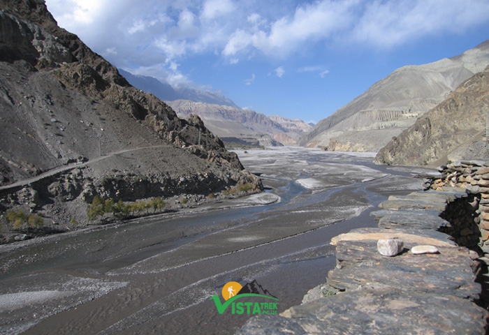
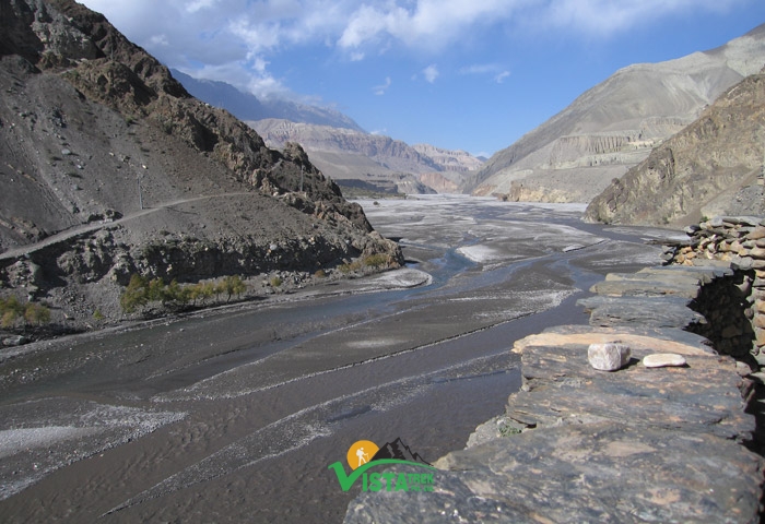
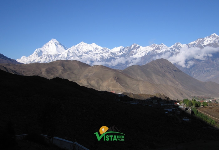
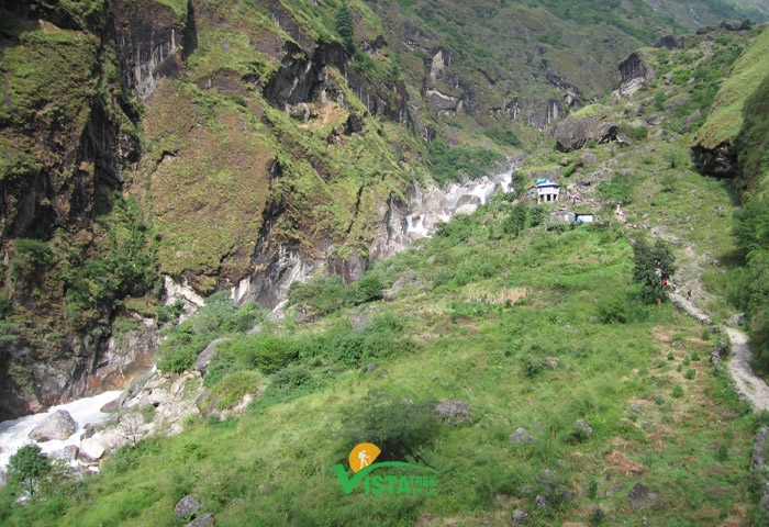
- After breakfast, we walk for approximately four and a half hours to Jomsom. As the trek nears Kagbeni, a major settlement, the nature, owing much to the Kaligandki Gorge, a landscape brought to its current state with the Kaligandaki River working its way through for about 6000 years now, showcases its ability to alter wind speeds according to variations in landscape. Walking from here on all the way to Marpha, everyone is forced to appreciate the sheer force of the wind, blowing at high speeds from the opposite direction. Kagbeni, built in the valley of the Kali Bandaki River, is bound to attract most traversing through its land, and,consequently, is a stopover for many.The red monastery, constructed almost in the middle of the Village, is a shrine most people do not choose to miss out on. In about two and a half hours’ time after leaving Kagveni, we walk through an utterly alien, almost lifeless, wasteland with patches of green indicating human settlement at sporadic intervals, and stop inJomsom (2,720 metres) for lunch.With the soaring peaks of Mt Dhaulagiri and Mt Nilgiri forming the backdrop, Jomsom, also known as the New Fort, is the administrative and commercial centre for the district with an airport that has regular flights to Phokhara.
- After lunch, we walk for around two hours to Marpha, a place famous for apples and, thereby, apple brandy, apple pie, apple pancakes and so on.
- This is where we spend the night this day.
- After breakfast, we walk for nearly three hours to Kokhethanti. Along the banks of Kali Gandaki, this gradual downhill turns a little sharper for just around ten minutes before we stop for lunch in Kokhethanti.
- After lunch, we walk again for around three more hours to Ghasa. Once leaving Kokhethanti, this part of the trek happens to pass through numerous other settlements: first Kalopani, then Lete. Many people find these villages, with their lush green forests close by, inviting for an extra night.
- We spend the night in Ghasa.
- After breakfast, perhaps after quite a few days, we do not start our walk, but stroll to Tatopani. RupseChahara (waterfall) on the way makes almost everyone stop at least for half an hour. On the banks of the mighty Kali Gandaki, Tatopani, our stopover for this day, also offers a dip in its hot spring waters for those wishing.
- We spend the night here.
- After breakfast, we walk for about two hours to Ghara. Crossing Kali Gandiiki and then GharKhola, a stream, the path turns steepuphill.This staircase like incline till Ghara Village is demanding for most. It is, however, well worth the effort since this part of the walk passes through a dense green forest.Ghara, a typical Nepali village, is the stopover for lunch.
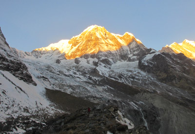
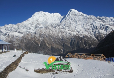
- After lunch, it’s time for the walk to Sikha. Still uphill but relatively comfortable, the route continues to offer the greenery. Upon arrival in Sikha, the view of Mt Dhaulagiri and Mt Annapurna South is what attracts the attention of all.
- Spend the night in a teahouse.
- After breakfast, we walk for almost two hours to Chitre Village. The trail is mostly a gradual climb, with sharper ones at places. As the gigantic mountains, the Annapurna South, Mt Dhaulagirand Mt Nilgiri, appear bigger and bigger, we stop in Chitre, a village similar toSikha but smaller.
- After the break, we start walking again for slightly more than two hours to Ghorepani. Through rhododendron forest and with half an hour of steep stone steps towards the end, the path brings everyone to Ghorepani. As one of the better equipped settlements to serve the tourist, with restaurants, cafes, pool houses and gift shops, the place, nestled in the middle of this forest, also offers a beautiful surrounding.In spring, the whole forest is in bloom with rhododendron flowers, mostly in red, some in pink and white sporadic.Lunch in Ghorepani satisfies most; a few seem never happy, though.
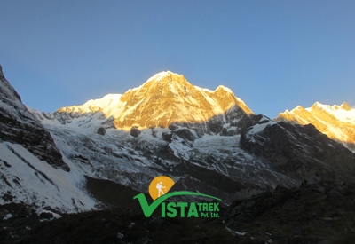
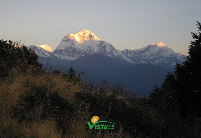
- At around 4 in the afternoon, we head off for Poon Hill. This one and a quarter of an hour journey uphill comes as taxing for many. Once atop Poon Hill, however, thesunset view, on a clear day, leaves none wanting for more: while the tops of the entire Annapurna Range glisten in shades of orange, the Dhaulagiri range opposite is more in the shadow and appears how it should in any normal dusk light. The walk back downhill from this vantage point takes most people around half an hour.
- Spend the night in a hotelin Ghorepani.
- Early morning, we walk to Poon Hill once again, but for a sunrise view this time around. The average period of one hour fifteen minutes spent on this vantage point in the early mornings presents everyone with a view that includes the glistening Dhaulagiri Range, the Annapurna Range opposite in shadow along with some incoming or outgoingJomsom/Phokharaaeroplanes flying past fromlower altitudes.
- Once back inGhorepaniand after breakfast, we start walking to Tadapani. With a sharp uphill for two hoursstill through a rhododendron forest, the trail continues with the Annapurna South, Mt Dhaulagiri as well as Mt Machhapuchréin view. After about two hours’ of traversing, the route arrives at a ridge. With the fading of rhododendron forest, the walk on the ridge lasts for roughly half an hour on gentle ups and downs.The next to follow is a two and a half hour downhill, through a forest once again, with a gorge sometimes to the left and at others to the right and sometimes along a stream that requires crossing wooden bridges at places.The next one and a half hour takes all travelers to Banthanti, a small settlement and our stopover for lunch. Lunch over and we walk the next half an hour further downhill until crossing a river. From here on, the climb is a sharp one all the way toTadapani.
- Spend the night here.
- Before sunrise, the view especially focuses on Annapurna South, Mt Himchuli and Mt Machhapuchréfrom Tadapani. After breakfast, we start the walk to Ghandruk. This sharp downhill starts to make many a legs go wobbling in no time. Except for some photo-n-drink breaks, the trek stops only inGhandrukin about three and a half hours’ time.
- After lunch in Ghandruk, a gradual downhill, lasting for about an hour and a half, takes usto the bus park in Syane. These final two and a half hours is a ride on a public vehicle to Phokhara as per this itinerary.
- We head off to Kathmandu on a tourist bus early morning. This almost six-hour journey passes through numerous important settlements with guaranteed two stops for breakfast and lunch. The bus ride finally comes to its stop in Kathmandu.
- Back in Kathmandu, and only your WILL shall dictate your involvement or indulgence as you may please since our arrival is in the afternoon. In the evening, however, please allow us the pleasure of your company during the fare-well dinner organized by Vista Trek.
- Spend the night in a hotel.
- If you have a morning flight, we leave for Tribhuwan Intl Airport early morning in a car arranged by the office.
- If your flight is in the late afternoon or evening, only your WILL shall dictate your involvement or indulgence as you may please before leaving for Tribhuwan Intl Airport in the vehicle.
Cost Includes
- Pick up and transfer by car from Airport-Hotel-Airport.
- 2 nights deluxe hotel accommodation in Kathmandu and one night in Pokhara with breakfast as per the itinerary.
- Breakfast, lunch and dinner during the trek.
- Local lodges accommodation during the trek.
- Government licensed guide,plus experience porters ( including their food, salary, accommodation, equipment, medicine & insurance).
- All local transportation by bus as per the itinerary.(Jeep driving from Besisahar-Chame and Jomsom-Tatopani, tourist bus to Pokhara -kathmandu)
- All necessary permits and entry fees.
- Medical kit box.
- Rescue assistance.
- All government taxes.
- Necessary equipment (sleeping bags, down jackets etc. if needed).
- Our service charge.
Cost Excludes
- Meals in Kathmandu & Pokhara.
- International airfare.
- Nepal entry visa fee ($40).
- Your travel insurance (should include your medical and rescue).
- Any personal expenses.
- Any kind of hot and cold drinks
- Staff & driver tipping.
Trip Gallery

Trip Map
Useful Info
About Accommodation.
In Kathmandu, we will accommodate you at Hotel Sapana Garden. Local lodges accommodation provided during the trek on twin sharing basis. Hotel in Kathmandu comes with private bathroom , however in mountain, toilet and shower will be on sharing basis. In the busy months, (October/November & April/ May) you may have to share the room with other traveler as some villages have limited number of local lodges .
About Meal
You can enjoy typical Nepali food as well as continental , Italian, Indian and Tibetan. Dinner and breakfast serve at the teahouse where we stay and lunch will be served on the way to next destination. In Kathmandu, only breakfast is provided. If you are a vegetarian or vegan, no worries, Nepal is such a easy place to get several vegetarian options.
About Staff:
A Guide and a porter assist you from Kathmandu to Kathmandu. In a group with more than 8 guests, 2 guide will be provided. A porter provided for 2 trekkers, and carries between 15 to 20 K.G.
About Equipments
Following Equipment list is recommended to bring for the trek.
Down Sleeping Bag, Down Jacket, Long sleeved shirt, Jumper or fleecy jacket, T – shirts, Trekking shoes or boots, Comfy shoes for around the camp, thick and warm woolen socks, Light cotton socks , A day bag to carry your valuable, Sun hat, Woolen hat, Gloves, rain coat, Sun block, lip balm , Goggles or sunglasses, Long underwear, Thermal wear, Nylon windbreaker, Nylon wind pants, Water bottle, Sewing kit, Medical & first aid kit, Flash light, Batteries and bulbs, Swiss army knife, Towel and toiletries etc. Please kindly check our Equipment list for complete details.
About Temperature.
Temperatures vary as per the elevation and season in Annapurna. Spring (March to May) and Autumn (September to December) is quite warm below 3000m that you can walk with t-shirts and shorts during day. Above Manang, day time temperature is around 5-10 °C and night time temperature is below 0 °C. Above Manang is generally cold through out a year and night time temperature can reach up to–20 °C in winter. There are no heating system inside the room in guest houses, therefore it is important to prepare warm clothes and sleeping bag for the trek.
Physical Fitness and experience
Annapurna Circuit Trek is a challenging trek which is fit for those who has the ability to walk 5-6 hours ups and downs in a day carrying own day bag. Some days are even longer with 7- 8 hours of walking, therefore this is not suitable for the beginner. This is high altitude trek which demands more physical fitness, However if you are strongly determined and have excellent health and average physical fitness can complete this trek. Few weeks prior to the trip, doing some physical exercise is better . No technical skill is needed however past experience also helps . If you are taking medicine for heart, lung or for blood diseases, please kindly consult your doctor and inform to Vista Trek P. Ltd.
About Insurance,
You have to obtain the travel insurance which should cover emergency evacuation and medical expenses. Some Insurance policy’s cover only up to 4000 meter, so please kindly confirm with the insurance company before you purchase it.
About Seasons
Spring and autumn seasons are the ideal seasons for Annapurna Circuit Trek. This is also known as rain shadow area, which is located right behind of Annapurna Mastiffs having least amount of rain compare to other area of Nepal. Therefore Raining season (June/July/August) is also good time for Annapurna Circuit Trek. Winter (December to February ) is generally not suitable for this Trek as the temperature is extremly cold and Thorang la Pass is also cover by heavy snow. But people with an experience of snow walking and used to in extream cold can complete this trek in winter too.
About Bus Drive
Highway in Nepal are safe, however sometime transport can be halted due to landslide , strike or by political issues. In such case trip itinerary will be affected. Thus, we would like to request you to add few days extra in Kathmandu. If you complete your trip smoothly, then you can enjoy your time with other activities like sightseeing, White water rafting. Jungle activities or more.
Please cheque our FAQs for various issues of the trek.
Trip FAQ's
The Annapurna Circuit Trek typically spans 20 days, starting from Kathmandu and journeying through diverse landscapes, including subtropical forests, terraced fields, and alpine meadows. The route takes trekkers over the Thorong La Pass (5,416 meters), one of the highest trekking passes in the world, and concludes in the Mustang region.
This trek is considered moderately challenging. It involves daily hikes of 5–8 hours, with significant altitude gains and steep ascents, particularly near Thorong La Pass. While the altitude gain is gradual, trekkers should be physically prepared for long walking days.
The optimal seasons are spring (March–May) and autumn (September–November). During these months, the weather is generally stable, skies are clear, and the trails are less crowded, offering the best trekking experience.
Trekkers need two essential permits: the Annapurna Conservation Area Permit (ACAP) and the Trekkers' Information Management System (TIMS) card. These can be obtained in Kathmandu or Pokhara through registered trekking agencies or the Nepal Tourism Board.
The trek offers breathtaking views of the Annapurna and Dhaulagiri mountain ranges, encounters with local cultures, visits to traditional villages, and the opportunity to witness diverse flora and fauna. The highlight is crossing the Thorong La Pass, where trekkers are rewarded with panoramic mountain vistas.